Mapxus Digital Building Body Check
Real-time indoor maps for fire services and emergency response.
One shared spatial foundation for safer, more resilient buildings.
Mapxus helps governments and property owners turn buildings from unknown risks into digitally visible, manageable, and insurable assets.

Mapxus enables both BIM-based and floorplan-based buildings to be digitalized under a single indoor map standard — making city-wide building safety management practical, not selective.
Mapxus links near-miss reports, incidents, inspections, and building health records directly to indoor maps — turning scattered safety data into actionable spatial intelligence.
Mapxus works alongside existing property management, facility management, and smart building systems — improving building safety digitally without redevelopment or heavy BIM investment.

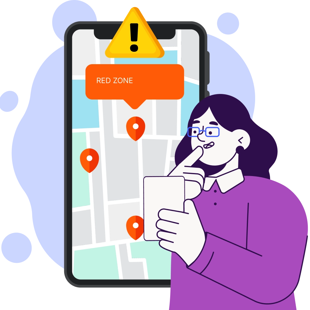
During an incident, every second matters. Mapxus equips responders with verified indoor maps that reveal the structure, assets, and risks inside a building — instantly.
Capabilities

Multi-floor indoor maps with clear zoning
Locations of fire alarms, panels, hydrants, exits
High-risk zones automatically highlighted
Visual routing for responders inside the building

Just as people undergo regular health checks, buildings need continuous digital safety assessments.
The Digital Building Body Check transforms static compliance into a living, up-to-date digital profile of building health.
What it includes
Verified indoor maps as the digital foundation
Fire safety asset locations and status
Maintenance and inspection records
Normal vs emergency operating states
Compatible to international standard COBie and LOD500
Safety is not only managed from control rooms.
Mapxus enables residents, occupants, and the public to report near-miss incidents, hazards, or SOS events directly on a map — using a simple web interface.
Report nearmiss incidents, blocked exits, smoking, fire hazards
SOS reporting with precise indoor location
Automatic routing to property management, security, and fire services

The challenge is not technology — it is scale.Mapxus uses an AI-assisted indoor data production pipeline to rapidly convert existing building floor plans into standardized indoor maps, without requiring BIM.
Floorplan → Indoor Map → (Optional) BIM alignment
Self-updating base data across the building lifecycle
City-wide rollout across residential and public buildings
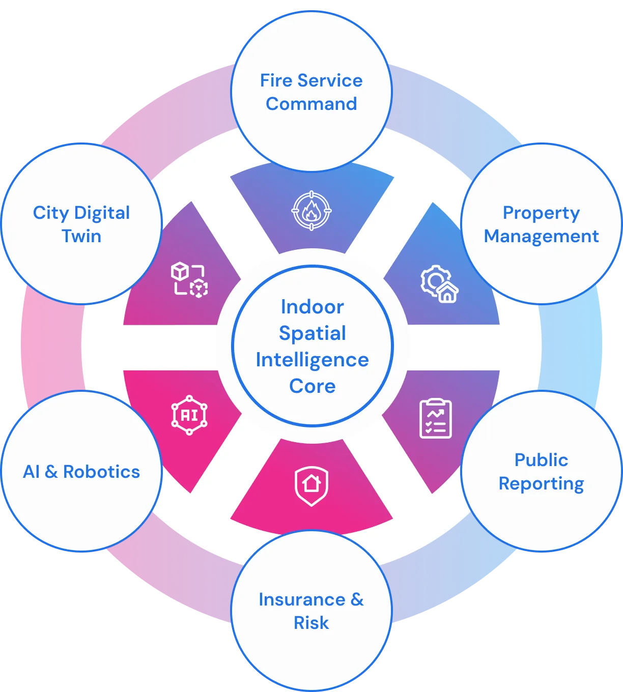
Extend・Integrate・Automate
As cities adopt AI, automation, and robotics, indoor spatial intelligence becomes the coordination layer.
Mapxus is built one map serves humans, AI, and machines, to support future emergency operations — not just today’s response.


Built on open standards • Sovereign-ready • Infrastructure-grade
Public safety systems require trust, sovereignty, and compliance by design.


Transform Your Building Experience
Turn Buildings from Black Boxes into Transparent, Safer Assets
Protect lives
Improve readiness
Build resilient cities